Categories
Environment & Biodiversity

Icequakes on the Ross Ice Shelf

  • Scientists discovered that the massive Ross Ice Shelf, which is nearly the size of France, shifts a few centimetres every day.
  • This occurs as a result of the Whillans Ice Stream, a fast-moving river of ice that occasionally becomes stopped before rapidly pushing onward.

About the Ross Ice Shelf.

  • Ross Ice Shelf is the biggest ice shelf in Antarctica, nearly the size of France.
  • It was found by Sir James Clark Ross on January 28, 1841.
  • The shelf covers around 500,809 square kilometres, which is comparable to France or Canada’s Yukon Territory.
  • It’s many hundred metres thick. The ice on the shelf’s southern portions, near the True South Pole, can be up to 750 metres thick. 
  • The virtually vertical ice front to the open sea is around 600 km long and rises 15 to 50 metres above the water’s surface. However, 90% of the floating ice lies below the water’s surface.
  • It is largely supplied by massive glaciers, or ice streams, which move ice from the high polar ice sheets of East and West Antarctica.
  • New Zealand claims the Ross Dependency, which includes the majority of the Ross Ice Shelf.
  • It floats in and covers a considerable area of the Ross Sea’s southern end, as well as Roosevelt Island to the east.

Spotlight: Icequakes on Ross Ice Shelf

  • Ice Stream Influence: While most glaciers flow slowly, the Whillans Ice Stream abruptly stops and restarts. This might happen because there isn’t enough water underneath to keep it moving smoothly.
  • Sudden motions: These motions, which resemble miniature earthquakes, press against the Ross Ice Shelf.
  • Threat to Stability: Although these daily fluctuations are not driven by people, they may weaken the Ross Ice Shelf over time. Ice shelves impede the movement of ice into the ocean.
  • Glacier retreat: If the Ross Ice Shelf weakens or breaches, melting may accelerate as sea levels rise. 
Source: https://in.mashable.com/science/73681/scientists-warn-of-icequakes-after-massive-antarctica-ice-sheet-makes-daily-jumps
Categories
Environment & Biodiversity

Pulicat Wetland

  • The settlement of claims for local communities inside the Pulicat Wetland and Bird Sanctuary limit raises concerns.
  • The state administration intends to denotify a major chunk of the sanctuary and Eco-Sensitive Zone (ESZ) for industrial park construction.

About Pulicat Wetland and Bird Sanctuary.

  • Pulicat Lake Bird Sanctuary is India’s second largest bird sanctuary.
  • It divides Andhra Pradesh’s Nellore district and Tamil Nadu’s Thiruvallur district.
  • The sanctuary is located along the coast of the Bay of Bengal and covers 759 square km. 
  • The sanctuary is bordered by the Arani River at its southern tip, the Kalangi River from the Northwest, and the Swarnamukhi River at the northern end.
  • Pulicat Lake lies adjacent to the Bay of Bengal and features a sandbar, making it a unique lagoon.
  • Sriharikota, known as India’s rocket launch pad and home to the Satish Dhawan Space Centre, divides the lake from the Bay of Bengal.
  • The sanctuary has 16 island communities and 30 villages.
  • bordering the lake, whose residents rely on the lake for a living.
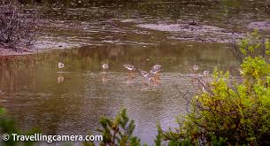
  • During the winter, the Pulicat Lake Bird Sanctuary attracts a huge number of migrating birds including as gulls, terns, plovers, shanks, curlews, and storks.
  • Flamingos, pelicans, storks, herons, and ducks all call this place home. 
Source: https://www.thehindu.com/news/cities/chennai/concerns-loom-over-damage-to-pulicat-wetland-as-claim-settlement-of-villages-in-the-sanctuary-begin/article68099021.ece
Categories
Environment & Biodiversity

Operation Jumbo: Capture Wild Elephants

  • The Forest Department has resumed Operation Jumbo in Karnataka’s Hassan district to catch troublesome wild elephants and fix radio collars.

What is Operation Jumbo?

  • The Karnataka government initiated Operation Jumbo to capture and radio-collar renegade wild elephants that frequently enter human habitations.
  • It is applicable in five districts across the state: Hassan, Chikkamagaluru, Kodagu, Ramanagara, and Bengaluru.
  • The goal of this programme is to regulate elephant mobility and disputes through continuous tracking with GPS-equipped radio collars that have a three-year battery life.

Implementation of Operation Jumbo

  • The expense of capturing and radio-collaring each wild elephant is around Rs 22 lakh, with each radio collar costing Rs 7 lakh imported from South Africa.
  • The operation requires a diverse team of 70-80 people, including forest rangers, veterinarians, mahouts, and other support personnel.
  • It entails tasks like monitoring, tracking, throwing wild creatures off the backs of trained elephants, and securing the rescued tusker.

Elephants in India

Details
Population EstimateAccording to the 2017 census, India has the greatest population of wild Asian elephants (Elephas maximus), accounting for around 60% of the global total. 
Leading StatesKarnataka holds the highest number of elephants, followed by Assam and Kerala.
Conservation StatusIUCN Red List:  Endangered.CMS: Appendix I.Wildlife (Protection) Act, 1972: Listed under Schedule I,CITES: Appendix I.
Conservation InitiativesProject Elephant was begun in 1992 and covers 23 states in India.Contributed to the wild elephant population growing from roughly 25,000 in 1992 to approximately 30,000 in 2021.Establishment of elephant reserves. Total of 33, encompassing approximately 80,777 square km. 
Source: https://www.hindustantimes.com/cities/bengaluru-news/karnataka-forest-department-resumes-operation-jumbo-to-capture-wild-elephants-101704992262384.html
Categories
Environment & Biodiversity

Veeranam Lake

  • Veeranam Lake, Chennai’s main supply of drinking water, has dried up.
  • Its supply was suspended due to a lack of input from the Mettur dam, located across the Kaveri River.

About Veeranam Lake

  • Veeranarayanapuram Lake, also known as Veeranam Lake, is an important water source for Chennai City.
  • It’s a man-made lake with a 16-kilometer-long dam. In the tenth century, it was around 20 kilometres long and 7 kilometres wide.
  • It is located in Tamil Nadu’s Cuddalore district, around 235 km distant.
  • The lake, located near Kattumannarkoil, has a storage capacity of around 1,465 million cubic feet (mcft) and plays an important role in supplying water to Chennai.

Historical Significance of Veeranam Lake

  • Built in the tenth century by Rajaditya Chola, a Greater Chola emperor.
  • The lake, formerly known as Veeranarayana Mangalam Lake, was constructed by Rajaditya Chola and his warriors during their stay in Thirumunaipadi during a war against the Pallava rulers.

Water sources and inflow

  • Veeranam Lake receives water from the Kollidam River via the Vadavaru River.
  • The lake’s inflow is supplemented by water discharged from the Mettur Dam via the Kollidam River and Lower Anicut, assuring enough water supply at times.
Source: https://www.downtoearth.org.in/news/water/another-bengaluru-in-the-making-chennai-s-main-drinking-water-source-veeranam-lake-dries-up-95592
Categories
Environment & Biodiversity

What percentage of global CO2 emissions come from aviation?

Aviation contributes 2.5% of worldwide CO2 emissions. However, it has contributed approximately 4% of global warming to date.

Year-wise Global Aviation Demand, Energy Efficiency, and CO2 emissions 

Global Co2 emissions from aviation 

The reason why aviation contributes for 2.5% of global CO2 emissions:

  • CO2 Emissions: When jet fuel burns, it emits carbon dioxide (CO2) into the atmosphere, much like any other combustion process. CO2, a greenhouse gas, has contributed around 4% of global warming to date.
  • Non-CO2 effects: In addition to CO2, aircraft emissions contain nitrogen oxides, soot, water vapour, and sulphate aerosols. These compounds interact with the atmosphere in a variety of ways, each with its own set of climate implications. For example:
    • Contrails are visible trails of condensed water vapour and ice crystals left behind aircraft in certain meteorological conditions. Contrails can help to generate cirrus clouds, which can warm the temperature.
    • Cirrus cloud formation is also induced by aircraft emissions, which contributes to global warming.

Way Forward:

  • Transitioning to Alternative Fuels: Invest in the research and development of sustainable aviation fuels (SAFs), such as biofuels, hydrogen, or synthetic fuels, which emit less CO2 than traditional jet fuel.
  • Improve Aircraft Efficiency: Promote the use of more fuel-efficient aircraft and technology, such as enhanced aerodynamics, lightweight materials, and efficient engines.
  • Implementing operational improvements: Improve air traffic management systems to optimise flight paths, reduce delays, and save fuel during taxiing, takeoff, and landing. 
Source: https://www.eesi.org/papers/view/fact-sheet-the-growth-in-greenhouse-gas-emissions-from-commercial-aviation
Categories
Environment & Biodiversity

Decoding the decision on Jim Corbett

The Supreme Court’s March verdict revealed the corrupt collaboration between politicians, forest officials, and local contractors that resulted in the illegal destruction of 6,000 trees in Uttarakhand’s Jim Corbett National Park. 

Key points linked to the judgement

  • The Supreme Court emphasised the importance of an eco-centric approach rather than anthropocentrism in ecotourism management.
  • Ban on Tiger Safaris in Core Areas: The court disagreed with the National Tiger Conservation Authority’s (NTCA) 2019 guidelines, which allowed for tiger safaris similar to those found in zoos in national parks. The court ordered the ban on tiger safaris in core areas of national parks, with the goal of minimising environmental damage and disturbance to wildlife habitats.
  • A committee was formed to investigate the potential of allowing tiger safaris in the peripheral parts of national parks across India, showing a cautious approach to balancing tourist and conservation objectives. 

What the Court Missed

Absence of Well-Defined approach: The court’s judgement to seek restoration costs from errant persons and officers lacks a well-defined approach, making it difficult to adequately estimate the harm done to Jim Corbett’s green cover.

Suggestive measures

  • Need for Ecosystem Services-Based Valuation: With the increasing degradation of biodiversity hotspots and support for revenue-generating eco-tourism, there is a need for a valuation technique based on ecosystem services, such as food, water, and climate regulation.
  • Precedent on Ecosystem Services: The court may have established a precedent by prioritising ecosystem services over eco-tourism or emphasising the importance of a clear legislation and policy governing ecosystem services, which are critical to environmental conservation and sustainable development.
  • Reference to the International Court of Justice (ICJ). Ruling: The International Court of Justice’s (ICJ) argument in Costa Rica v. Nicaragua (2018) addressing the compensability of environmental damage might have been used to better comprehend approaches for measuring environmental damage and loss of ecosystem services.
Source: https://www.thehindu.com/opinion/op-ed/decoding-the-supreme-court-judgment-on-jim-corbett/article68064918.ece#:~:text=The%20judgment,-National%20and%20State&text=The%20court%20directed%20the%20banning,Jim%20Corbett%2C%20but%20across%20India.
Categories
Environment & Biodiversity

Microbial formulations for increased agricultural productivity

The Indian Institute of Spices Research (IISR), based in Kozhikode, has developed and validated three new microbial formulations (Bactolime, Bactogypsum, and Trichogypsum) to boost agricultural production. 

IISR Microbial Formulations

  • It uses granular lime and gypsum to improve soil pH while also introducing beneficial microbes.
  • These are created with IISR’s exclusive patent-applied technology.
  • The formulations are:
  1. Bactolime:
  • The flagship product, Bactolime, combines beneficial bacteria, notably Rhizobacteria, which promote plant growth, with liming material in a single formulation.
  • This integration not only corrects soil acidity but also provides critical nutrients to plants. 
  1. Bactogypsum and Trichogypsum:
  • The other two formulations, Bactogypsum and Trichogypsum, use gypsum as a basis to keep soil pH near neutral.
  • These formulations improve soil structure, increase the availability of secondary nutrients, and increase total microbial activity by providing an ideal environment for beneficial bacteria.
Source: https://www.ncbi.nlm.nih.gov/pmc/articles/PMC10749938/#:~:text=Proper%20and%20suitable%20application%20of,reliance%20on%20expensive%20and%20toxic
Categories
Environment & Biodiversity

Total Solar Eclipse

  • On April 8, there will be a rare total solar eclipse viewable across North America.

What are eclipses?

  • Eclipses are astronomical events in which the sun, moon, and Earth align in precise ways.
  • There are two types of eclipses: solar and lunar. 
  1. A solar eclipse occurs when the moon passes between the sun and the Earth on a new moon, blocking the sun’s light.
  2. A lunar eclipse happens when the Earth passes between the sun and the moon during a full moon, producing a shadow on the moon.

What is a total solar eclipse?

  • During a total solar eclipse, the moon passes between the sun and Earth, completely concealing the sun’s face along a short path across our planet’s surface.
  • This is referred to as the “path of totality.”
  • The midday sky darkens, comparable to dusk or dawn, and nocturnal animals have been observed to awaken, mistaking it for nighttime. 

Stages of Total Solar Eclipse

  1. A total solar eclipse has multiple unique stages.
  2. The partial eclipse phase begins when the moon passes between Earth and the sun, partially blocking it and giving the sun the appearance of a crescent shape.
  3. Because of the irregular lunar terrain, points of sunlight shine around the moon’s edges during the subsequent Baily’s Beads phase, resulting in little beads of light.
  4. During the diamond ring phase, a single brilliant spot appears along the lunar edge, while the sun’s atmosphere creates a ring of light around the moon. This phenomena precedes totality.

Following totality, the other phases repeat as the moon continues on its journey until the eclipse ends.

Other types of solar eclipses:

  1. Partial Solar Eclipse
  • This occurs when the Sun, Moon, and Earth are not perfectly aligned.
  • The sun appears to cast a dark shadow over only a small portion of its surface. 
  1. Annular Solar Eclipse
  • An annular eclipse occurs when the moon is at its farthest distance from Earth. Because the moon is farther from Earth, it seems smaller. It does not obscure the complete view of the sun. The moon in front of the sun appears as a dark disc on top of a larger sun-coloured disc. This forms what appears to be a ring around the moon.
  • During a solar eclipse, the moon throws two shadows across Earth. The initial shadow is known as the umbra. This shadow becomes smaller as it approaches Earth. It is the darkest part of the moon’s shadow.
  • The second shadow is known as the Penumbra. The penumbra expands as it approaches Earth. People standing in the penumbra will witness a partial eclipse. People standing in the umbra will witness a total eclipse.

Why don’t solar eclipses occur on every New Moon?

  • The Moon’s orbit tilts 5° relative to Earth’s orbit around the Sun.
  • Astronomers refer to the two points at where these pathways intersect as nodes.
  • Eclipses occur only when the Sun is at one node and the Moon is either New (for solar eclipses) or Full (for lunar eclipses).
  • During most (lunar) months, the Sun is either above or below one of the nodes, therefore no eclipse occurs. 
Source: https://www.thehindu.com/news/international/rare-total-solar-eclipse-to-shadow-north-america-today-check-details-here/article68041602.ece
Categories
Environment & Biodiversity Geography

The Ramapo Fault

  • In a rare occurrence, New York City experienced a 4.8 magnitude earthquake.
  • The Ramapo Fault in the Appalachian Mountains near New Jersey is being investigated as a possible cause of this earthquake. 

About the Ramapo Fault

  • Fault lines are fissures in the Earth’s crust that allow tectonic plates to move and so cause earthquakes.
  • The Ramapo Fault is the result of tectonic activity caused by the breakup of the supercontinent Pangaea during the Mesozoic Era.
  • It is largely a right-lateral strike-slip fault caused by horizontal movement along the fault line as the North American and Eurasian plates move together.
  • While the Ramapo Fault is not as seismically active as other faults in the region, it has previously generated earthquakes and is still a potential source of seismic risks.

Geographical Distribution:

  • The fault spans three northeastern states, including Pennsylvania, New Jersey, and New York.
  • The fault runs across a variety of geographical features, including rift valleys, hills, and ridges, highlighting the region’s rich geological history.
  • It crosses with the Appalachian Mountains, altering the surrounding landscape.
Source: https://www.northjersey.com/story/news/2024/04/05/earthquakes-nj-science-cause-history-ramapo-fault-scale/73217244007/
Categories
Environment & Biodiversity

Indian Laurel Tree (Terminalia tomentosa)

  • Forest Department experts examined an Indian laurel tree (Terminalia tomentosa) in Papikonda National Park and discovered its extraordinary water storage capacity.
  • This discovery gives information on the Konda Reddi tribe’s indigenous understanding of the tree’s distinctive characteristics.

Konda Reddi Tribe.

  • The Konda Reddis are a Particularly Vulnerable Tribal Group (PVTG) in Andhra Pradesh’s Godavari and Khammam districts, where they live along the Godavari River and in mountainous forest areas.
  • The family structure is patriarchal and patrilocal, with monogamy being the norm with few exceptions.
  • The Konda Reddis are predominantly Hindus, with folk practices that include local traditions and the worship of community-level deities.
  • They have their own social control institution, the ‘Kula Panchayat’.
  • Each village has a traditional headman known as ‘Pedda Kapu’, whose position is hereditary.
  • Their principal profession is shifting farming, with nourishment provided by forest plants and fauna.
  • Jowar farming is widespread, and it serves as the people’s basic diet.
  • They supplement their income by collecting and selling non-timber forest products like as tamarind, adda leaves, myrobolan, and broomsticks.

About Papikonda National Park

  • The Papikonda National Park is located in Andhra Pradesh’s East and West Godavari districts.
  • It was designated a national park in the year 2008.
  • It is distinguished by steep scenery and abundant damp deciduous forests.
  • The Godavari River runs through the Papikonda hill range in the Eastern Ghats.

About Indian Laurel Tree

Description
Scientific NameTerminalia tomentosa
Common NamesIndian Laurel Tree, Crocodile Bark Tree, Anjan Tree
HabitatFound in Deciduous forests
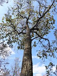
BarkScissored and cracked bark, resembling crocodile skin (From November to February)
Water Storage AbilityOnly 5-10% of trees observed to store water in the stem
Water Storage MechanismDevelopment of lateral ridge, known as a wing, on trunk, indicating water presence
Water Collection4-6 litres of potable water can be collected from a fully grown tree by making a small hole in the wing
Traditional UseTribal populations, such as the Konda Reddi Tribe, use it as a water supply during the dry season.
AdaptabilityThrives in a variety of environments, including extreme weather and drought.
Source: https://www.inaturalist.org/taxa/68657-Terminalia-tomentosa
JOIN OUR NEWSLETTER
And get notified everytime we publish a new blog post.