Categories
Environment & Biodiversity

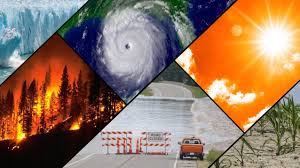
Described Climate: Heatwaves and Climate Change

  • According to the Indian Meteorological Department (IMD), heatwave conditions hit either smaller regions or bigger geographical areas in India on the 26th of the month.

What are Heat Waves?

  • The “World Meteorological Organisation” defines a heat wave as five or more consecutive days in which the daily maximum temperature is five degrees Celsius higher than the average maximum temperature.
  • A heat wave occurs when the highest temperature in a certain location exceeds 45 degrees Celsius for two consecutive days.

Impact of Heatwaves:

  • Impact on Resource Availability:
    • Water Resources: It exacerbates water shortages by causing water bodies to dry up, decreasing water availability for agricultural and residential use, and increasing resource competition. This can lead to water-related disputes, change irrigation methods, and have an impact on water-dependent sectors.
    • Energy Resources: It raises electricity demand for cooling, putting a pressure on power networks and perhaps causing blackouts. This can interrupt economic activity, reduce productivity, and hurt vulnerable people. 
  • Impact on Health:
    • Prolonged heat exposure can cause dehydration, as well as cardiovascular and respiratory illnesses.
    • Rapid increases in heat gain can impair the body’s capacity to regulate temperature, resulting in a series of disorders such as heat cramps, heat exhaustion, heatstroke, and hyperthermia.
    • The Health Ministry recorded 264 heat-related fatalities in the first six months of 2023. The NCRB recorded 730 heat-related fatalities in the same year. 

However, data gathered and maintained by the IMD and NDMA (National Disaster Management Authority) show a significant decrease in heat-related mortality since state governments and district administrations implemented heat action plans. 

To mitigate heatwaves

  • Build an early warning system. The Inter-Agency Coordination must notify citizens of projected high and severe temperatures. Individuals and units of essential departments are informed of who will do what, when, and how, particularly in the health sector.
  • Improve Public Awareness and Community Outreach: Distributing public awareness messages about how to safeguard against the excessive heat wave using social media and commercials. Furthermore, the government should educate the general people about the Do’s and Don’ts of heat-related diseases via television programmes. 

Conclusion: 

Improve engagement with non-governmental and civil society organisations to improve public spaces as needed, improve water distribution systems in public locations, and implement other creative strategies to combat heatwave conditions. 

Source: https://indianexpress.com/article/explained/explained-climate/explained-climate-heatwaves-climate-change-9329251/#:~:text=A%20new%20study%20has%20attributed,and%20intense%20in%20the%20country.&text=The%20extreme%20heat%20in%20parts,been%20attributed%20to%20climate%20change.
Categories
Environment & Biodiversity

Aurora Borealis: What are the Northern and Southern Lights? Why do they happen?

  • In a rare occurrence, the northern lights, or aurora borealis, filled the night sky over Hanle hamlet in Ladakh.
    • Concurrently, the southern lights, or aurora australis, were seen in New Zealand and Australia. 

What are Auroras?

  • Auroras are natural light displays that seem like dazzling, twirling curtains in the night sky.
  • They are most commonly spotted at the poles, although they may also be found at lower latitudes.
  • The interaction of sun particles with various gases in the Earth’s atmosphere causes these lights to exhibit a variety of colours, including blue, red, yellow, green, and orange. 
  • The phenomenon is known as:
  1. Aurora borealis in Northern Hemisphere and
  2. Aurora australis in Southern Hemisphere

What creates auroras?

  • Interaction with Earth’s Magnetic Field: As the solar wind reaches Earth, it interacts with the planet’s magnetic field, allowing some charged particles into the atmosphere near the poles.
  • Interaction with Gases: When these particles interact with gases in the high atmosphere, they produce bright flashes of light. Collisions with oxygen generate green light, but interactions with nitrogen produce blue and purple light.

Impact on Technical Infrastructure

  • Auroras can disrupt space-based systems and activities.
  • Such incidents may cause disruptions to Global Positioning Systems (GPS), radio communications, airline operations, power grids, and space research efforts. 
Source: https://m.economictimes.com/news/international/us/northern-lights-will-there-be-more-aurora-borealis-sightings-in-the-us/articleshow/110041083.cms#:~:text=The%20Northern%20and%20Southern%20Lights,with%20the%20Earth's%20magnetic%20field.
Categories
Environment & Biodiversity

Cloud seeding creates artificial rain

  • The Uttarakhand administration was under examination by the Supreme Court following forest fires that cost lives in the state.
  • The justices emphasised the ineffectiveness of depending entirely on cloud-seeding or rain gods to handle the situation.

About Cloud Seeding

  • Cloud seeding is a weather manipulation method that involves releasing compounds into clouds to increase rainfall or snowfall.
  • It is used to reduce hail, disperse fog, and induce or avoid precipitation on future days.
  • Silver iodide, potassium iodide, dry ice, and hygroscopic items like table salt are all dispersed into the environment.

Techniques include:

  1. Static seeding increases ice particle production in supercooled clouds, whereas 
  2. Dynamic seeding boosts convective cloud growth by releasing latent heat.
  • Dispersion techniques vary from aircraft and ground-based generators to newer options such as drones that emit electric charges or infrared laser pulses.

Limitations: Impact on the Environment and Health.

  • Concerns remain about the possible buildup of seeding agents in delicate ecosystems, despite extensive studies revealing little consequences.
  • The chemicals utilised, such as silver iodide, may possibly harm the environment and create health problems including iodine poisoning in high amounts. 
Source: https://www.dri.edu/cloud-seeding-program/what-is-cloud-seeding/
Categories
Environment & Biodiversity Science & Tech

West Nile Fever Outbreak in Kerala

  • The Kerala government reported the resurgence of West Nile disease cases in Thrissur, Malappuram, and Kozhikode districts.
  • West Nile fever was initially identified in Kerala in 2011, with a fatal case reported in 2019 involving a six-year-old from Malappuram.

What is West Nile Fever?

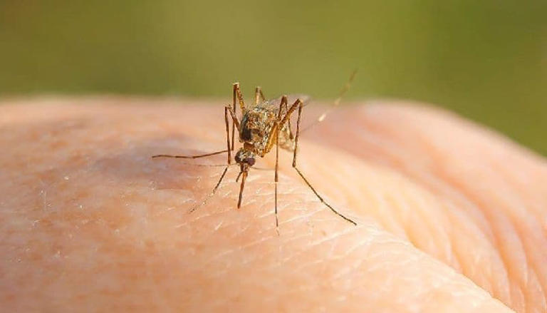
  • West Nile fever is caused by the West Nile Virus (WNV), which spreads by bites from infected Culex mosquitos.
  • WNV is a mosquito-borne, single-stranded RNA virus.
  • According to the World Health Organisation, it is a flavivirus from the Japanese Encephalitis antigenic complex in the Flaviviridae family.

How is it spread?

  • Infected mosquitoes transmit the virus between humans and animals, particularly birds, which serve as the virus’s reservoir host.
  • Mosquitoes become infected after feeding on infected birds, which carry the virus in their bloodstream for a few days.
  • The virus finally enters the mosquito’s salivary glands.
  • During subsequent blood feasts (when mosquitos bite), the virus may be transferred into people and animals, where it can grow and potentially cause sickness.
  • WNV can also spread by blood transfusions, transmission from an infected mother to her child, or laboratory contact to the virus.
  • It is not known to spread through contact with sick people or animals. 

Symptoms of WNV infection:

  • WNV infection causes no symptoms in 80% of cases.
  • The rest get West Nile fever, sometimes known as severe West Nile illness.
  • In 20% of instances, symptoms include fever, headache, tiredness, body pains, nausea, rash, and swollen glands.
Source: https://www.indiatvnews.com/health/west-nile-fever-cases-in-kerala-know-causes-symptoms-and-prevention-tips-of-this-mosquito-borne-disease-2024-05-08-930190#:~:text=The%20fever%20was%20first%20detected,the%20fever%20in%20Thrissur%20district.
Categories
Environment & Biodiversity

Uttarakhand Forest Fires

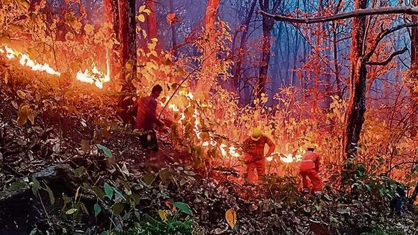
  • Last week, three forest fires were recorded from Uttarakhand’s major forest belts.
  • The gravity of the crisis has compelled the deployment of Indian Air Force soldiers and Mi-17 choppers to perform the essential operation of dousing the flames with the Bambi Bucket Method.

Causes of wildfire:

  • To begin, the most common causes of forest fires in Uttarakhand are prolonged dry weather and a lack of moisture in the woods.
  • Second, the Forest Research Institute (FRI, 2019) reports that human activities cause 95% of forest fires.
  • Common human-caused causes include grazers starting fires on dry grass, slash-and-burn agriculture, unattended campfires, and intentional arson.

Uttarakhand’s Forest Vulnerability:

  • Uttarakhand has a Recorded Forest Area (RFA) of 38,000 sq km, including 26,547 sq km reserved, 9,885 sq km protected, and 1,568 sq km unclassified.
  • Chir Pine trees, which are very combustible and cover large areas, add to the risk of fire.
  • This danger is exacerbated by extended dry spells and excessive biomass buildup.
  • Furthermore, the closeness of communities encourages human activity like forest clearing and grazing. 

Mitigation Strategies

  1. Localized Initiatives: 
  • Controlled burning, biomass clearance, planned burns, and drone-based surveillance are all effective ways to reduce the danger of forest fire.
  • Community interaction and proactive involvement, as seen in Kerala, offer vital insights into forest fire management. 
  1. Government Initiatives:
  • The government has implemented measures such as a satellite-based fire alarm system by the Forest Survey of India to help in early identification and response.
  • Forest personnel use a variety of measures, such as counter-fires and fire beaters, to efficiently confine and manage forest fires. 
Source: https://www.thehindu.com/news/national/supreme-court-to-urgently-hear-uttarakhand-forest-fire-petitions-on-may-8/article68145088.ece
Categories
Environment & Biodiversity

The Clean Energy Transition has become nasty

The war in the Middle East, Russia and Ukraine, as well as US sanctions, have resulted in a fragmented petroleum industry. 

Causes of Fragmentation in the Petroleum Industry

  • The Impact of Sanctions The US sanctions on Venezuela, Iran, and Russia have resulted in a fragmentation of the petroleum sector, with trading links becoming more regional than global. This fragmentation has changed the dynamics of oil supply and demand, with various areas dependent on distinct suppliers based on geopolitical factors and sanctions. 
  • Regional Trading Patterns: The petroleum industry’s trading ties have evolved geographically, with the United States becoming as a key supplier of LNG and goods in Europe, Russia being India’s top crude supplier, and Iran focusing on shipments to China despite Western sanctions. The regionalization of commerce has disrupted conventional market dynamics and diversified supply networks.
  • Challenges for Oil Companies: International petroleum corporations are reporting strong profits as oil and gas output and prices rise. However, they must integrate their investment strategy with net zero carbon emission ambitions. Oil firms have a tremendous problem in combining revenue and sustainability goals. 
  • Geopolitical Uncertainties: The continuous wars in the Middle East, notably between Israel and Iran, have exacerbated the difficulties of the oil market. The area, which houses a substantial share of the world’s petroleum reserves, is suffering a combination of violence, bigotry, and extremism, adding to heightened tensions and uncertainty in the oil sector.
  • Energy demand in the AI industry: The artificial intelligence (AI) business is increasing its energy need for data centres, cloud storage facilities, and cryptocurrency mining. This rising need for power presents a hurdle since renewables may be unable to match the demands, creating a quandary for industry leaders dedicated to attaining net zero carbon emissions. 

What should be done?

  • Diversification of Energy supplies: To reduce the effects of geopolitical uncertainty and sanctions-induced market fragmentation, governments must diversify their energy supplies.
  • Regional Cooperation Agreements and Partnerships Can Help Stabilise Petroleum Markets and Ensure Energy Security.
  • Promotion of Energy Efficiency: Improving energy efficiency in a variety of sectors, including transportation, industry, and residential structures, can reduce overall energy consumption and reduce reliance on petroleum products. 
Source: https://foreignpolicy.com/2020/06/18/green-energy-dirty-side-effects-renewable-transition-climate-change-cobalt-mining-human-rights-inequality/
Categories
Environment & Biodiversity

Taam Ja: The World’s Deepest Blue Hole

  • Researchers in Mexico discovered the world’s deepest blue hole, known as Taam Ja’ Blue Hole (TJBH).

About

  • Taam Ja’ Blue Hole (TJBH) is the world’s deepest known sinkhole, measuring at least 1,380 feet (420 metres) below sea level.
  • It is located in Chetumal Bay, off the southeast coast of the Yucatan Peninsula.
  • It was discovered in 2021 and was initially estimated to be 900 feet deep.
  • This discovery beats the previous record holder, the Sansha Yongle Blue Hole in the South China Sea, by an astonishing 480 feet. 

Research Expedition and Findings

  • Scientists used a conductivity, temperature, and depth (CTD) profiler to gather information on the environmental conditions inside the blue hole.
  • Despite reaching depths of 1,640 feet (500 metres), the CTD profiler was unable to reach the bottom of TJBH, demonstrating its incredible depth.
  • Data from the profiler showed the presence of many water layers within the blue hole, with conditions similar to those found in the Caribbean Sea at depths below 1,312 feet (400 metres). 
Source: https://m.economictimes.com/news/international/us/inside-worlds-deepest-blue-hole-with-caves-and-tunnels-know-what-is-blue-hole-how-it-is-made/articleshow/109744004.cms#:~:text=The%20world's%20deepest%20known%20blue,the%20end%20of%20the%20hole.
Categories
Environment & Biodiversity

Analysis: A chunk of India’s forests is’missing’ following a 27-year delay in filing reports

The Supreme Court ordered the MoEFCC to submit State Expert Committee findings on unclassified forests owing to concerns about the validity of the Forest (Conservation) Act Amendment 2023, which affects the conservation and probable diversion of these woods.

What are the present issues?

  1. The missing forests in SECs 
  • Undercut the prior judgement: The MoEFCC informed a Parliamentary Committee that SECs had identified unclassified forests, which aligned with the proposed Forest (Conservation) Act Amendment, notwithstanding earlier criticism that the bill undercut the Godavarman decision.
    • However, an RTI application found that the MoEFCC claimed not to have the SEC reports, casting doubt on its statement to the Parliamentary Committee.
  • Lack of validated data: Following a Supreme Court ruling, the MoEFCC posted the SEC reports, but they revealed a lack of reliable information on the identity, status, and location of unclassified woods.
  • Seven states and union territories, including Goa, Haryana, and Tamil Nadu, did not form SECs, while others did not completely comply with Supreme Court directions.
  • Non-traceable Forest: Ladakh established an SEC only after the dissolution of Jammu and Kashmir, and Puducherry’s report was pronounced “not traceable,” showing anomalies in the process. 

2. Disagreement with FSI data 

  • Insufficient timeline: Many states believe that the Supreme Court’s one-month deadline was insufficient for complete work owing to the task’s size.
  • Relied on existing data: Rather than completing ground-truthing, physical cadastral surveys, and delineation of unclassified forest lands, most states relied on forest and revenue department data. Some states, such as Manipur and Sikkim, merely cited data from the Forest Survey of India.
  • Question about Data: The data’s trustworthiness is called into doubt, as Haryana’s report is unclear about data sources and compilation dates. Only nine states reported the amount of unclassified woods, while the remainder concentrated on the various categories of forest lands listed in the order. 

3. Lack of clarity in the Reports:

  • Most states and UTs neglected to describe the geographic locations of forests in their SEC reports, making the information given mostly ineffective for correct identification and preservation.
    • Tripura was an outlier, supplying Khaitan statistics for forest areas above what was officially reported, although land categorization remained ambiguous.
  • Lack of on-the-ground verification: The SEC’s failure to conduct on-the-ground verification may have resulted in extensive destruction of forests that should have been recognised and preserved nearly 30 years ago.
    • Kerala’s SEC’s exclusion of biologically significant places such as Pallivasal and Chinnakanal unreserves, which are crucial for wildlife corridors and conservation, demonstrates a lack of vigilance in identifying and safeguarding vital forest areas.

Suggested measures:

  • Extended schedule: Give governments a more realistic schedule for conducting complete surveys and data verification, taking into account the volume of the job and the importance of accuracy.
  • Ground Truthing and Surveys: States must perform ground truthing, physical cadastral surveys, and demarcation of unclassified forest lands to guarantee proper identification and mapping of forest areas.
  • Data Verification: To guarantee dependability and consistency, implement processes for evaluating and cross-referencing data acquired from multiple sources, such as forest and revenue agencies, as well as the Indian Forest Survey.
Source: https://www.thehindu.com/sci-tech/energy-and-environment/unclassed-forests-missing-27-year-delay-to-file-state-sec-reports-analysis/article68117352.ece#:~:text=The%20Forest%20Survey%20of%20India's,cycle%20of%20the%20Survey's%20review.
Categories
Economics Environment & Biodiversity

Towards Green Growth: The RBI and a Green Taxonomy

Extreme weather conditions, as well as protracted geopolitical tensions, may put inflation at risk, according to the Reserve Bank’s April Bulletin, released on April 23.

The RBI’s Monetary Policy Report examines the influence of climatic shocks and extreme weather occurrences on food inflation: 

  • Effects of Food Inflation: The paper emphasises the importance of extreme weather events and climatic shocks in influencing not just food inflation, but also the natural rate of interest and financial stability.
  • Broader Economic influence: Climate shocks and extreme weather events are stated as having a broader influence on the economy’s financial stability, implying that interruptions in food production and supply chains caused by these occurrences might result in inflationary pressures outside of the food industry.
  • Economic Modelling: The study discusses the use of a New-Keynesian model with a physical climate risk damage function to evaluate the macroeconomic impact of climate change. This is likely to contain forecasts of how climatic shocks may influence food production and, as a result, food inflation. 
  • Long-Term Output Reduction Warning: According to the analysis, if climate mitigation policies are not implemented, long-term economic output might fall by around 9% by 2050. This shows that climatic shocks and extreme weather occurrences may have long-term repercussions on food output and inflation.
  • Potential for Inflation Hysteresis: There is a warning that inflation hysteresis may become established, leading to a de-anchoring of inflation expectations. This suggests that ongoing disruptions induced by climatic shocks may result in continuous rises in food inflation. 

Way forward: 

  • Need Investment in Climate Resilience: Governments and corporations may invest in climate-resilient agriculture techniques and infrastructure to reduce the negative impact of extreme weather events on food production.
  • Need Diversifying food supplies can help lessen reliance on places vulnerable to climatic disturbances. This might include encouraging local food production, assisting small-scale farmers, and investing in alternative food production techniques such as vertical farming or hydroponics. 
Source: https://www.thehindu.com/opinion/editorial/towards-a-green-growth-the-hindu-editorial-on-the-rbi-and-a-green-taxonomy/article68117880.ece
Categories
Environment & Biodiversity

Icequakes on the Ross Ice Shelf

  • Scientists discovered that the massive Ross Ice Shelf, which is nearly the size of France, shifts a few centimetres every day.
  • This occurs as a result of the Whillans Ice Stream, a fast-moving river of ice that occasionally becomes stopped before rapidly pushing onward.

About the Ross Ice Shelf.

  • Ross Ice Shelf is the biggest ice shelf in Antarctica, nearly the size of France.
  • It was found by Sir James Clark Ross on January 28, 1841.
  • The shelf covers around 500,809 square kilometres, which is comparable to France or Canada’s Yukon Territory.
  • It’s many hundred metres thick. The ice on the shelf’s southern portions, near the True South Pole, can be up to 750 metres thick. 
  • The virtually vertical ice front to the open sea is around 600 km long and rises 15 to 50 metres above the water’s surface. However, 90% of the floating ice lies below the water’s surface.
  • It is largely supplied by massive glaciers, or ice streams, which move ice from the high polar ice sheets of East and West Antarctica.
  • New Zealand claims the Ross Dependency, which includes the majority of the Ross Ice Shelf.
  • It floats in and covers a considerable area of the Ross Sea’s southern end, as well as Roosevelt Island to the east.

Spotlight: Icequakes on Ross Ice Shelf

  • Ice Stream Influence: While most glaciers flow slowly, the Whillans Ice Stream abruptly stops and restarts. This might happen because there isn’t enough water underneath to keep it moving smoothly.
  • Sudden motions: These motions, which resemble miniature earthquakes, press against the Ross Ice Shelf.
  • Threat to Stability: Although these daily fluctuations are not driven by people, they may weaken the Ross Ice Shelf over time. Ice shelves impede the movement of ice into the ocean.
  • Glacier retreat: If the Ross Ice Shelf weakens or breaches, melting may accelerate as sea levels rise. 
Source: https://in.mashable.com/science/73681/scientists-warn-of-icequakes-after-massive-antarctica-ice-sheet-makes-daily-jumps
JOIN OUR NEWSLETTER
And get notified everytime we publish a new blog post.