Categories
Environment & Biodiversity Geography

The Ramapo Fault

  • In a rare occurrence, New York City experienced a 4.8 magnitude earthquake.
  • The Ramapo Fault in the Appalachian Mountains near New Jersey is being investigated as a possible cause of this earthquake. 

About the Ramapo Fault

  • Fault lines are fissures in the Earth’s crust that allow tectonic plates to move and so cause earthquakes.
  • The Ramapo Fault is the result of tectonic activity caused by the breakup of the supercontinent Pangaea during the Mesozoic Era.
  • It is largely a right-lateral strike-slip fault caused by horizontal movement along the fault line as the North American and Eurasian plates move together.
  • While the Ramapo Fault is not as seismically active as other faults in the region, it has previously generated earthquakes and is still a potential source of seismic risks.

Geographical Distribution:

  • The fault spans three northeastern states, including Pennsylvania, New Jersey, and New York.
  • The fault runs across a variety of geographical features, including rift valleys, hills, and ridges, highlighting the region’s rich geological history.
  • It crosses with the Appalachian Mountains, altering the surrounding landscape.
Source: https://www.northjersey.com/story/news/2024/04/05/earthquakes-nj-science-cause-history-ramapo-fault-scale/73217244007/
Categories
Geography

Subduction zone detected beneath Gibraltar Strait

  • Scientists in Portugal have discovered a disturbing revelation about the fate of the Atlantic Ocean, pointing to a possible ‘Ring of Fire’ (a Subduction Zone).
  • Researchers warn that the Atlantic may be on the verge of closing owing to subduction activity. 

About Gibraltar Strait

Details
LocationIt connects the Atlantic Ocean to the Mediterranean Sea, separating Europe’s southern Iberian Peninsula from Africa’s northern coastline. 
WidthAt its narrowest point, it measures around 13 kilometres (8.1 miles).
DepthVaries, with the deepest point reaching approximately 300 metres (984 ft).
FormationThe convergence point of the Eurasian and African plates.Around 5.33 million years ago, during the Messinian salinity crisis, the Atlantic Ocean overcame the barrier separating it from the Mediterranean Sea, causing a catastrophic deluge known as the Zanclean flood.The current shape and depth of the strait have been impacted by tectonic movements and erosional processes throughout geological time.
Historical SignificanceServes as an important marine route for trade and military objectives.
DisputesGibraltar is a disputed territory between Spain and the United Kingdom. It is now under British administration. 

What are Subduction Zones?

  • Subduction zones form at convergent plate borders, where two tectonic plates move closer together.
  • This convergence typically occurs between an oceanic plate and a continental plate, or between two oceanic plates.
  • Subduction Process: 
  1. When two tectonic plates collide, the denser oceanic plate is pushed beneath the less dense continental plate or another oceanic plate.
  2. Partial Melting: As the oceanic plate descends into the mantle, it generates great heat and pressure, resulting in partial melting of the mantle material.
  3. Volcanic Activity: Molten material created during the subduction process rises through the Earth’s crust, causing volcanic eruptions at the surface.
  4. Volcanic Arc Formation: These eruptions frequently occur in long chains known as volcanic arcs that run parallel to the subduction zone. For example, consider the Andes in South America and the Cascade Range in North America.

Implications for this Activity

  • Earthquakes in subduction zones can be especially damaging, triggering tsunamis due to the displacement of massive volumes of water.
  • Trench Formation: A subduction zone’s surface representation is frequently a deep oceanic trench where the descending plate bends and plunges into the mantle.
  • Mountain construction: Over time, the ongoing subduction of oceanic crust can cause uplift and deformation of the overriding plate, leading in the construction of mountain ranges around the subduction zone. These mountains may have complicated geological formations, such as folds and faults.
  • Recycling of Oceanic Crust: As oceanic plates subduct, the mantle gradually consumes them, releasing minerals and elements that are eventually reintroduced to the surface via volcanic activity. 
Source: https://timesofindia.indiatimes.com/home/science/subduction-zone-discovered-beneath-gibraltar-strait-concerns-raised-over-future-of-atlantic-ocean/articleshow/108645478.cms#:~:text=Although%20the%20current%20subduction%20zone,the%20next%2020%20million%20years.
Categories
Geography

Darien Gap

  • In recent weeks, much of the discussion about illegal immigration to the United States has shifted southward to the Darien Gap.

What is Darien Gap?

  • The Darien Gap connects northern Colombia and southern Panama, crossing around 97 kilometres of dense jungle terrain.
  • It is located in the narrowest region of Panama’s Isthmus, which connects North and South America.
  • It has an area of about 41,440 square km.
  • The scenery is defined by lush rainforests, wetlands, rivers, and rocky mountains.
  • It is one of the world’s most biologically diverse locations, with a vast range of plant and animal species, including jaguars, pumas, tapirs, and a variety of birds.

Why is this in the news?

  • Illegal crossings are on the rise. The Panamanian government reported an astounding 133,000 crossings in 2021, with over half a million people expected to pass through the region by 2023.
  • Root Causes: Individuals, including Venezuelans, Haitians, and Afghans, are driven to make the risky voyage due to violence, insecurity, and a lack of legal immigration choices in their home countries.
Source: https://en.wikipedia.org/wiki/Dari%C3%A9n_Gap
Categories
Environment & Biodiversity Geography

Kambalakonda WLS

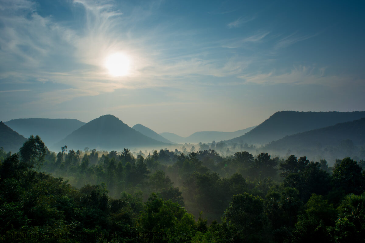
The Eastern Ghats Biodiversity Centre, located near PM Palem in Visakhapatnam on the outskirts of the Kambalakonda Wildlife Sanctuary, has a new Nature Interpretation Centre.

About

Details
LocationVisakhapatnam district, Andhra Pradesh, India
EstablishmentDeclared in 1970 under the Wildlife Protection Act of India
AreaApproximately 71 square kilometers (27 square miles)
EcosystemDry evergreen forests and scrubland
BiodiversityHome to Indian leopards, deer species, wild boar, jackals, reptiles, birds, and medicinal plants
FloraPredominantly dry evergreen forests with moist deciduous patches
Tourism and RecreationOffers trekking, bird watching, and nature walks
AccessibilityEasily accessible from the city of Visakhapatnam
Source: https://forests.ap.gov.in/kambalakonda.php
Categories
Geography

The Apollo 17 connection with moonquakes

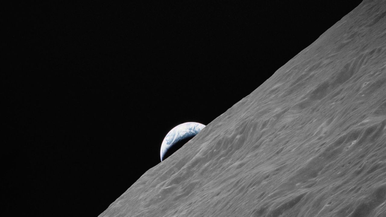
  • A study used seismic data acquired between 1976 and 1977 to indicate how the Apollo 17 astronauts’ lunar lander could be affecting seismic activity on the moon.
  • The study emphasises that these moonquakes are caused by vibrations induced by the lunar module descent vehicle, which was deployed on the moon’s surface in 1972.

The Apollo 17 Mission

  • Apollo 17 was the sixth lunar landing and the final Apollo mission to the Moon.
  • It was launched by night on December 6, 1972, which was unprecedented in the Apollo programme.
  • This mission was distinct from earlier missions in that it sought to collect ancient highlands crustal material and examine the potential of recent lunar volcanic activity.
  • Neil Armstrong became the first person to set foot on the lunar surface on July 20, 1969, as part of the Apollo 11 mission.

Understanding Moonquakes’ Relationship to Earthquakes:

  • Moonquakes are similar to earthquakes in that they both entail seismological vibrations.
  • Researchers have identified four types of moonquakes, three of which are relatively benign. Shallow moonquakes, the closest to the surface, are the most destructive.
  • Deep Moonquakes: These occur 700 km below the lunar surface.
  • Shallow moonquakes occur at depths of only 20 to 30 kilometres and can last up to 10 minutes.
  • Vibrational Moonquakes: These are caused by meteorite collisions.
  • Thermal quakes are caused by the moon’s crust expanding as it warms after a night of subzero temperatures.
  • Moonquakes occur as frequently as every 27 days, mostly due to temperature differences between lunar day and night, with an estimated 7,000 moonquakes occurring in a decade.

Earthquakes vs. Moonquakes

  • Moonquakes are often less in magnitude than earthquakes, but they have a longer duration.
  • Apollo astronauts detected shallow moonquakes with a magnitude of up to 5.5.

Human Moon Landings

  • Several countries have launched lunar missions, the most recent being India in 2023, following the United States, Russia, and China.
  • The seismometer on India’s Chandrayaan-3 spacecraft detected a moonquake, providing vital data for future investigation.

The Importance of Monitoring Moonquakes

  • Understanding moonquakes could be useful for future lunar missions, especially if NASA creates a permanent lunar colony.
  • Seismometers, such as those used on the moon, are critical for understanding lunar geology and assuring future lunar travellers’ safety.
  • Monitoring lunar seismic activity is critical for developing experiments and expeditions aimed at elucidating the mysteries of Earth’s nearest celestial neighbour.
  • The moon offers a once-in-a-lifetime chance for in-depth planetary research beyond Earth.
Source: https://www.cnn.com/2023/09/14/world/moonquakes-apollo-17-scn/index.html
Categories
Geography

Sulina Channel

As Russia threatens ships in the Black Sea, the ‘Sulina Channel’ in Romania provides a lifeline for Ukraine’s grain exports.

Sulina Canal

  • The Sulina Channel is located in Romania’s southeastern area, specifically in the Danube Delta region.
  • It connects one of Europe’s major rivers, the Danube, to the Black Sea, offering a direct route for maritime transportation.
  • The channel is approximately 64 kilometres long, making it an important shipping and navigation route.
  • It is an important trade route for cargo ships, commercial ships, and other maritime traffic entering and exiting the Black Sea region.
  • The Sulina Channel was built in the nineteenth century to assist the navigation of large ships and boats into and out of the Danube Delta.

Importance for Ukraine

  • The Sulina waterway, the Danube’s only deep and wide waterway, serves as a vital “riverine motorway” for carrying products from inland Ukrainian ports to the Black Sea.
  • Ukrainian grain ships go on the Chilia Channel from Izmail and Reni to Sulina, where the cargo is transferred to larger vessels.
  • These ships then travel to Constanta, Romania’s main seaport, for onward transfer into the Mediterranean.
  • This route is under NATO’s monitoring and protection, providing some protection against Russian aggression.
Source: https://indianexpress.com/article/explained/explained-global/the-importance-of-the-sulina-channel-to-ukraine-grain-trade-8895778/
Categories
Geography

Katchatheevu Islands

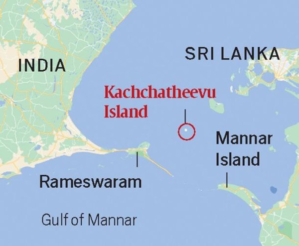
  • Katchatheevu has become a symbol of historical conflict, political strife, and a reminder of difficult geopolitical decisions.
  • The Prime Minister’s use of Katchatheevu during a parliamentary debate fueled continuing debate about this small island tucked between Tamil Nadu and Sri Lanka.

The History of Katchatheevu Island

  • Colonial Influence: Katchatheevu, a 285-acre island, was formed by a volcanic explosion in the 14th century. It was traditionally ruled by the Jaffna monarchy of Sri Lanka and, later, the Ramnad Zamindari of India.
  • British-era claims: In the early twentieth century, both India and Sri Lanka claimed Katchatheevu to set fishing boundaries. Even throughout the British Raj, the ownership controversy persisted.

Landmark Decision in the 1974 Indo-Sri Lankan Maritime accord:

  • Indira Gandhi’s government chose to give Katchatheevu to Sri Lanka as part of the 1974 accord aimed at establishing maritime borders.
  • Political Implications: The judgement sparked outrage in Tamil Nadu, where residents criticised the lack of engagement with the state assembly and the impact on traditional fishing rights.
  • Ambiguity in Fishing Rights: Although the agreement granted Indian fishermen access to Katchatheevu “hitherto,” fishing rights remained vague, resulting in disputes.

Sri Lankan Civil War and Beyond Civil War Dynamics:

  • As Sri Lanka’s naval forces dealt with domestic unrest, the attention switched away from the Katchatheevu issue.
  • After the civil war, Sri Lanka strengthened its marine defences, resulting to the arrest of Indian fishermen who ventured into their waters, reigniting calls for Katchatheevu’s return.

Persistent Concerns in Tamil Nadu

  • Political Reaction: Tamil Nadu lawmakers from all parties objected to relinquishing Katchatheevu without state assembly approval, citing historical links and economic implications.
  • Legal squabbles: The AIADMK of late J Jayalalitha filed petitions challenging the 1974 accord, claiming it violated customary fishing rights. The Union government’s position, however, remained unchanged.
  • Position of the Modi government: Despite strong protests from Tamil lawmakers, the Modi government maintained that the island’s status was finalised in 1974 and that regaining it would necessitate extreme actions.

The Implications for Today

  • Katchatheevu represents regional and sovereignty concerns, illustrating tensions between Tamil Nadu’s interests and decisions made by the central government.
  • Geopolitical Dilemma: In the context of bilateral ties, the case demonstrates the delicate balance between historical claims, political sentiments, and international accords.
Source: https://indianexpress.com/article/explained/explained-politics/pm-modi-katchatheevu-tamil-nadu-8887679/#:~:text=Prime%20Minister%20Narendra%20Modi%2C%20in,to%20Sri%20Lanka%20in%201974.
Categories
Geography

Kuril Islands

  • Russia’s invasion of Ukraine continues, posing issues in resource allocation along the country’s western border.
  • Japan sees this as an opportunity to retake the Kuril Islands, also known as Japan’s Northern Territories, which were captured by Soviet soldiers during WWII.

About

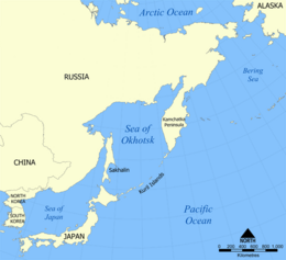
  • The Kuril Islands, commonly known as the Kurile Islands, are an archipelago of volcanic islands in the northern Pacific Ocean.
  • They extend from the northeastern tip of Japan’s Hokkaido to the southernmost point of Russia’s Kamchatka Peninsula.
  • It consists of 56 islands, the most important of which are Iturup, Kunashir, Shikotan, and Habomai.
  • The Kuril Islands are part of the Pacific Ring of Fire, an area of severe volcanic and seismic activity caused by tectonic plate movement.
  • Several active volcanoes can be found on the islands, including Alaid, Ebeko, and Chikurachki.

What exactly is the point of contention?

  • Since the end of World War II, the islands have been a source of contention between Russia and Japan.
  • Following the war, the Soviet Union seized control of the Kuril Islands, displacing around 17,000 Japanese people.
  • The southernmost islands (Iturup, Kunashir, Shikotan, and Habomai) are claimed by Japan and referred to as the “Northern Territories.”
  • Russia retains authority over the islands and regards them as an extension of its territory.
  • The territory dispute has prevented Russia and Japan from negotiating a formal peace treaty to officially conclude World War II hostilities.
Source: https://indianexpress.com/article/explained/explained-global/could-china-take-kuril-islands-claimed-by-japan-and-russia-8869904/
Categories
Geography

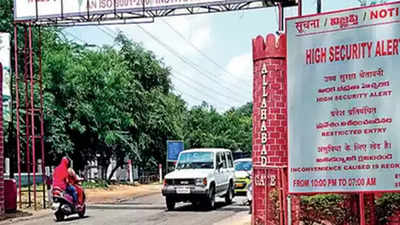
Cantonment Civil Area Excision and Merger

  • The Ministry of Defence (MoD) has proposed excising civic zones in 58 cantonments around the country and merging them with State municipalities.
  • Earlier in May, the administration announced an intention to eliminate the country’s 62 cantonments as “archaic colonial legacies.”

What are Cantonments?

  • Cantonments are permanent military stations that house a group of military personnel for administrative functions. The Cantonments Act of 2006 governs these territories and provides for municipal administration and oversight.
  • India currently has 62 cantonments distributed throughout many states, with some regions known for having greater infrastructure and facilities than other parts of the country.
  • Cantonment Boards: Cantonments are controlled by Cantonment Boards, which are democratic entities made up of members who are elected and nominated. The Station Commander of the Cantonment serves as the Board’s ex-officio President.

Historical Context

  • The British passed the Cantonments Act in 1924 to govern cantonment municipal government.
  • Following India’s independence, the Cantonments Act was amended to reflect the country’s democratic structure.
  • The current Cantonments Act, 2006, superseded the previous version, with the goal of giving Cantonment Boards more authority and accountability.

Cantonment categories from the past

  • Cantonments are classified according to the size of their populations:
  • Cantonments with a population of more than 50,000 are classified as Category I.
  • Cantonments having a population of 10,000 to 50,000 are classified as Category II.
  • Cantonments with a population of less than 10,000 are classified as Category III.
  • Industrial or training cantonments, regardless of population size, fall into Category IV.

Broader plan

  • Conversion to Exclusive Military Stations: According to the proposal, military areas within all cantonments will be classified as “exclusive military stations.” The Army will have “absolute control” over these sectors, which will streamline administration and operations.
  • The civilian areas of cantonments will be merged with the respective local municipalities. These municipalities will be in charge of maintaining these territories as well as providing vital services and infrastructure.
  • Abandon the Traditional Cantonment Concept: Following independence, the Indian Army abandoned the traditional cantonment system, owing to disagreements between military and civilian administrations. Certain important cantonments, like as Pune Cantonment and Agra Cantonment, remained operational.
Source: https://www.thehindu.com/incoming/mod-proposes-excision-of-58-cantonment-boards-including-scb/article67116172.ece
Categories
Environment & Biodiversity Geography

Climate targets are becoming obsolete: India requires its own

The media has focused on the 1.5 degree Celsius warming target and the impact of El Nio this year. While exceeding this temperature threshold is reason for concern, the exaggerated end-of-the-world narrative around the climate issue should be reconsidered.

The main idea

The Paris Agreement’s ambition of limiting global warming to 2 degrees Celsius by 2100 has been hailed as a monumental achievement. Nonetheless, despite more than two decades of agreements, global carbon emissions have not slowed. Furthermore, the aim was not arrived at scientifically. Instead than focusing on dire scenarios, it is critical to handle the climate crisis from a more balanced standpoint.

What is the target temperature of 2 degrees Celsius?

  • The Paris Agreement was adopted by nearly all governments of the globe in 2015, during the United Nations Climate Change Conference (COP21) in Paris.
  • The agreement’s main goal is to keep global temperature rise below 2 degrees Celsius above pre-industrial levels.
  • The 1.5 degree Celsius objective was set in response to concerns expressed by vulnerable countries, notably tiny island governments.
  • To meet the 2°C target, countries must submit nationally determined contributions (NDCs) outlining their intended efforts to reduce greenhouse gas emissions.
  • To combat climate change, the Paris Agreement emphasises the significance of global cooperation and collaborative action.

What exactly are Earth System Models (ESMs)?

  • ESMs are sophisticated computational models that climate scientists use to mimic the Earth’s climate system.
  • These models are intended to reflect the interactions and feedbacks between diverse Earth system components such as the atmosphere, oceans, land surface, ice, and biogeochemical processes.
  • These models solve these equations numerically over a global grid, allowing scientists to mimic climate processes and changes on both short and long time scales.

Key concerns regarding 2 Degrees target

  • The 2 degree Celsius objective was not developed on the basis of solid scientific data or a thorough grasp of the potential consequences of such warming.
  • Despite worldwide efforts and obligations under the Paris Agreement, global carbon emissions have not decreased significantly.
  • The 2 degrees Celsius target may be insufficient to overcome regional variability in climate impacts.
  • Climate predictions using ESMs struggle to effectively mimic regional-scale climate fluctuations, particularly in regions like the Indian subcontinent.
  • There are concerns regarding the ability to differentiate between the effects of 1.5 and 2 degrees Celsius warming and to build region-specific climate adaptation programmes.

India faces uncertainty

  • Uncertainties in ESMs make predicting regional climate impacts at the scale of the Indian subcontinent problematic.
  • Water supply, precipitation patterns, and glacial melt in the Himalayas are all affected by climate change. The unpredictability of these factors can have serious consequences for India’s total water security.
  • Climate prediction uncertainties have an impact on India’s agricultural sector, making it difficult to predict crop yields and plan for food security.
  • Coastal areas in India, especially major cities such as Mumbai and Kolkata, are exposed to the effects of rising sea levels, increasing the danger of flooding and coastal erosion.
  • Climate change has the potential to increase health difficulties such as heat-related illnesses, vector-borne infections, and air pollution. Uncertainties about how climate change affects disease patterns make effective public health measures difficult to develop and implement.
Source: https://www.thehindu.com/sci-tech/energy-and-environment/predicting-climate-change-carbon-emissions-failure/article67109068.ece
JOIN OUR NEWSLETTER
And get notified everytime we publish a new blog post.