
- Siachen NJ 9842 vs. 5Q 131 05 084: First GSI Survey Exploring the final delimited point between India and Pakistan, as well as the number assigned to the Siachen glacier by the Geological Survey of India (GSI).
- Despite its historical significance, the initial Siachen survey has gone unnoticed by researchers and mountaineers.
Concerning Siachen
- Siachen Glacier is located in the Himalayas’ eastern Karakoram range, slightly northeast of where the Line of Control between India and Pakistan terminates.
- Siachen Glacier, the world’s second-longest glacier in non-polar locations, runs for 76 km and is historically and strategically significant.
Geographic and Political Setting
- Border dispute: Since 1984, both India and Pakistan have claimed sovereignty over the whole Siachen region, resulting in occasional conflict.
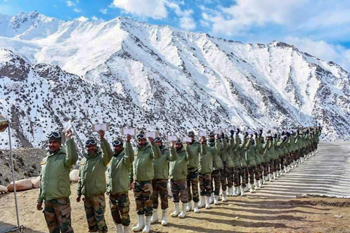
- Military presence: The region is home to the world’s highest battleground, with permanent military stations at heights above 6,000 metres (20,000 feet).
- International recognition: Efforts have been made to build a transboundary peace park and nominate the territory for the World Heritage List.
Why discuss Siachen?
- Human casualties: Both India and Pakistan have suffered substantial losses as a result of harsh climatic conditions.
- Attempts at demilitarisation have failed: Despite the desire to disengage from costly military outposts, the lack of governmental acknowledgement of the current line of authority has stymied progress.
- Mountaineering expeditions and public awareness: Only a few trips have been permitted to demonstrate Indian forces’ supremacy and create public awareness about the region.
The First Survey of Siachen
- Leadership of V.K. Raina: V.K. Raina, an Indian geologist, conducted the first Siachen survey in June 1958.
- Unforeseen conflict: The tranquil territory surveyed in 1958 became a contentious area between India and Pakistan in 1984, resulting in Operation Meghdoot.
Himalayan Exploration by Geologists
- Raina’s previous excursions include the Saser Kangri expedition and the geological assessment of the Leh-Manali Highway.
- Year of the International Geophysical Year: The significance of 1958 as a year of geological research around the world.
- The limited resources of GSI: Raina was sent to survey five glaciers in Ladakh as part of GSI’s effort to explore Himalayan glacier systems.
Raina’s Adventure and Discoveries
- Expedition details: Raina’s party travelled by train, bus, and foot from Calcutta to Siachen.
- Characteristics of glaciers: Raina’s observations on the Siachen glacier, include the formation of ice caves and the flow of the Nubra River.
- Procedures for conducting surveys: The snout region is being mapped, reference points are being established, and images are being taken for future examination.
Pakistan’s Reaction
- There were no objections: Despite the importance and visibility of the mission, Pakistan made no protests or objections to India’s presence on the glacier during the survey.
- Reasons for passivity: The lack of objections can be linked to the mutual delineation established by the Karachi ceasefire agreement, as well as the absence of perceived threats or occupying intents.
Contesting Pakistan’s Claims
- Importance of the expedition: The 1958 GSI survey is significant historically and strategically since it challenges Pakistan’s early claims to the Siachen glacier.
- Pakistan’s postponed claim: Only 25 years later, in 1983, did Pakistan formally extend the Line of Control, claiming the region and breaking the Simla Agreement.
- India’s reaction: In response to Pakistan’s attempts to claim the Siachen glacier, India occupied the strategically important Saltoro Heights in April 1984.
Source: https://www.thehindu.com/news/national/the-first-gsi-survey-of-the-siachen/article67077315.ece